James Edward Oglethorpe founded the colony of Georgia in 1733 to be a place for people seeking a second chance. Slavery, strong drink (rum) and lawyers were outlawed as part of Oglethorpe’s attempt to establish a moral society.
John and Mary Musgrove who lived and ran a trading post a few miles upriver from where Oglethorpe founded Savannah were asked to be Oglethorpe’s interpreters with the local native tribes. Mary was part Creek Indian and was born into a prominent Creek family in Coweta Town on the banks of the Ocmulgee River (modern-day Macon, GA). John Musgrove died shortly after the founding of the colony and Mary became Oglethorpe’s lead ambassador and interpreter to the Indians.
After establishing and naming the towns of Savannah and Augusta, Oglethorpe led a contingent of settlers, soldiers and mercenaries to St. Simons Island. While on their way to St. Simons Island, Oglethorpe’s people camped on St. Catherines Island. John Wesley, who later returned to England and helped to start Methodism, was with Oglethorpe that night on St. Catherines. While Oglethorpe was in residence on St. Simons, Spaniards from St. Augustine landed on the island in an attempt to remove the British from the area. As the Spanish soldiers were seeking the English settlement, the Georgians ambushed them. A number of the Spaniards were killed and a few were captured. The Spanish left St. Simons within a few days of the ambush. The place on St. Simons where the battle took place is still called Bloody Marsh. Oglethorpe went home to England in 1743 and never returned to Georgia.
Shortly after Oglethorpe’s departure for England, the moratorium on slavery was lifted. Lawyers were allowed into the colony and of course strong drink followed. Rather than becoming a place for second chances, Georgia became a place for second sons who would come in search of land.
Thomas and Mary (Musgrove) Bosomworth took up residence on St. Catherines Island sometime in the 1740s.Bosomworth, an Anglican minister was Mary’s third husband. Several Yamassee Indian families were also living on St. Catherines Island at that time.
In 1753 Jonathan Bryan, the son of a South Carolina planter led a party through the environs of coastal Georgia. His stated purpose for the journey was to look for land. A few years earlier, Bryan accompanied Oglethorpe during a failed attack on St. Augustine. Adam Bosomworth (Thomas Bosomworth’s brother) greeted Bryan’s group when they arrived on St. Catherines Island. They landed at 8 o’clock in the evening of August 10th. The next morning Adam Bosomworth, took the travelers on a 3-hour walk across the island to the beach and back. Bryan wrote in his journal, “This island is one of the most pleasant and agreeable place(s) in all Georgia”. He also mentions “the middle of the island appears a perfect Meadow being a large Savanna” (Wood and Bullard). Today – Bryan’s perfect meadow is called the Central Depression. Pine trees have, for the most part, replaced the grass. A team of scientists from two museums, three Georgia universities, two out-of-state universities and members of the St. Catherines Island staff are working together to understand the origins and workings of that mysterious (scientifically) part of the island. They call themselves the Central Depression Consortium. Bryan also saw “springs and… crystal streams.” There are no springs or streams on the island today. Bryan County, Georgia is named for Jonathan Bryan. One of the men on that voyage with Bryan was William De Brahm, a German engineer, surveyor and mapmaker.
Mary and Thomas Bosomworth gained legal title to St. Catherines Island in 1760. William De Brahm (who had accompanied Bryan in 1753) and Henry Yonge surveyed the island for the colony and made a map from that survey. A photocopy of the Yonge and De Brahm map hangs in the living room of the Button Gwinnett House today. Upon Mary Musgrove’s death five years after she gained title, Bosomworth sold the island to Button Gwinnett. Gwinnett was to become a signer of the Declaration of Independence and Georgia’s first “President of the Assembly” (a title later called governor). Gwinnett resided on St. Catherines for 11 years. He was killed in a duel during the Revolution. After the Revolutionary War, the title to the island was in debate and the courts apportioned the island. The 18th century ended with St. Catherines Island being divided into several different tracts with multiple owners.
Related Publications
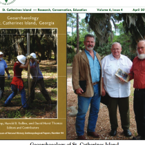
Geoarchaeology of St. Catherines Island, Georgia
The field of geoarchaeology has typically been defined as either geology pursued within an archaeological framework or sometime the reverse, as archaeology framed with the help of geological methodology. Either way, the formalized objectives of geoarchaeology define a broad range of pursuits, from placing archaeological sites into relative and absolute temporal context through the application of stratigraphic principles and absolute dating techniques, to understanding the natural processes of site formation, to reconstructing the landscapes that existed around a site or group of sites at the time of occupation.
- Date Published : April 2011
- Read more
25th Annual Christmas Bird Count, December 17th, 2011
On Friday, December 16th, 42 birders hopped on boats at the mainland eager to get to St. Catherines and check out their assigned areas in preparation for Saturday, the 25th Christmas Bird Count (CBC) on SCI. This is part of The National Audubon Society’s 112th CBC, with the count taking place in over 2,000 locations from December 14th—January 5th.
This year was our third best count with 140 species and 33,383 individuals on count day. Four additional species were seen during count week, and the total of 144 matched (with 2002) the highest number during count-week.
- Date Published : January 2012
- Read more
After 30 Years of Animal Research, Bronx Zoo to Close Island Preserve
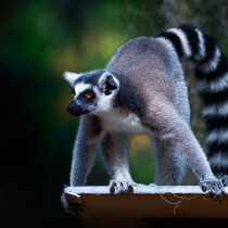
The Bronx Zoo has closed a large animal preserve on a 14,000-acre undeveloped island off the coast of Georgia, where for 30 years zoologists have studied – among other things – the mating habits of wildlife, including lemurs, hartebeests, zebras, tortoises, gazelles and several species of exotic birds.
- Source : The New York Times
- Date Published : December 29, 2004
- Read more
Lemurs, hartebeests, hornbills call island home
In the interior of St. Catherines Island, deer roam freely and wild hogs jog playfully throughout the woods. Suddenly, in the distance, a sound not native to the area is heard. A group of ring-tailed lemurs hangs from the trees, a small herd of African Jackson hartebeests prances by, and an exotic great hornbill bird is spotted. Welcome to the sanctuary of St. Catherines Island Wildlife Survival Center.
- Source : The Coastal Courier
- Date Published : June 8, 2009
- Read more
The Saint behind St. Catherines Island
Do you ever wonder where St. Catherines Island got its name? Recent research on artifacts recovered at Mission Santa Catalina de Guale, located on St. Catherines Island, has provided some insight into this very question. Ironically, the information regarding the name source comes to us from an object recovered on Amelia Island (Florida). There are actually four Santa Catalina de Guale missions in Spanish Florida. The earliest (Santa Catalina de Guale I), built on St. Catherines Island, was attacked in 1680 by British troops and Indian allies, probably in a slave raid. After the attack, the residents relocated to nearby Sapelo Island, establishing the second location of Mission Santa Catalina (II, 1680–1683).
- Date Published : April 2012
- Read more
Recent History of the North Pasture
Most of the Gopher Tortoises on St. Catherines Island live in North Pasture. Some have formed colonies on other parts of SCI only to return to North Pasture after a few years. Some people call North Pasture (NP) the “North Savanna”. Some have described it as a Long-leaf Pine Flat-wood and another as a managed Long-leaf Pine forest. It was Georgia’s largest stand of mature LL pine on a barrier island when the logging began (1938). Mr. Noble purchased the island in 1943. At that time loggers held timber contracts for most of the remaining timber on SCI.
- Date Published : April 2013
- Read more
Throughfall and Stemflow in the Forest Canopy
Forests provide many known ecosystem services— they clean our air, sequester our carbon emissions, protect our soils from erosion, provide habitat for species on which we rely for sport and ecotourism, and much more. While the list goes on, there are likely even more ecosystem services which have yet to be discovered. What other amazing services do forests provide to our ecosystem? That’s the question at the heart of Dr. John Van Stan’s (Fig. 1) research on St. Catherines Island. To begin answering this question, Dr. Van Stan is currently installing monitoring equipment that will allow him and his colleagues at Georgia Southern University, Skidaway Institute of Oceanography, and the Helmholtz Centre for Environmental Research (in Leipzig, Germany) to track water and nutrients as they move from the canopy into the soils and freshwater lens and, ultimately, out to the ocean. They expect to find new forest influences over each of these ecosystem components critical to barrier islands as a whole.
- Date Published : August 2012
- Read more
Survey of St. Catherines Island’s Aquatic Beetles
Students of the department of Biological and Environmental Sciences at Georgia College reveled in the opportunity to explore St. Catherines Island and its aquatic fauna with me. These students (from five countries) are currently participating in classes, including Entomology, Aquatic Entomology, and Invertebrate Zoology as well as independent research. Most of the students come fully trained with collecting and curating techniques of invertebrates and particularly beetles, and are already quite adept for our task of collecting and analyzing beetles of SCI.
- Date Published : December 2012
- Read more
Southeastern American Kestrels
In January 2012, St. Catherines Island hosted the 1st Southeastern American Kestrel Working Group meeting, led by Ken Meyer of Avian Conservation and Research Institute (ACRI). This meeting was a culmination of a planning project being facilitated by ACRI with a National Fish and Wildlife Foundation grant to understand the status of and concerns for the SE American Kestrel. Florida, Mississippi, Alabama, and Georgia state and federal personnel attended to report the status of the birds in their area, and to identify needs that each state has to learn more about the status of these Kestrels and understanding their limiting resources. Coming together as a cooperative working group gives biologists and land managers a better understanding of large-scale needs and resources of this species and their habitats.
- Date Published : February 2012
- Read more

